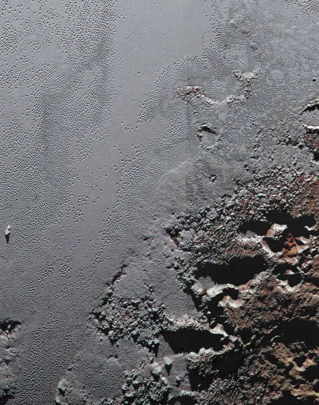
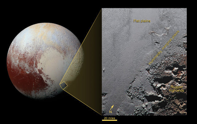
NASA released an image of an area of Pluto informally called Krun Macula that shows the variability on the dwarf planet. Obtained by putting together various photographs taken by NASA’s New Horizons space probe during its July 14, 2015 flyby, it shows the border area between the icy plains of the heart-shaped region and the nearby highlands.
The name of the area comes from Krun, the lord of the underworld in the Mandean religion, and the word macula that means a dark region on a planet’s surface. In fact, only in the highlands the color tends to be dark but all around there are different ones, confirming the variety of the existing geological features around Krun Macula.
In the vast plain called Sputnik Planum, which became famous for its heart shape, the prevailing colors are white of the ice and the red probably due to the presence of tholins. Those are hydrocarbons present on most of Pluto’s surface and could be created by the reactions caused by solar ultraviolet radiation interacting with molecules such as those of methane or ethane present in the atmosphere.
Krun Macula is located about 2.5 kilometers (1.5 miles) above the Sputnik Planum plains and is marked by groups of connected, nearly circular pits that generally have a diameter between 8 and 13 kilometers (between 5 and 8 miles) and a depth of up to 2.5 kilometers (1.5 miles). At the border with Sputnik Planum, the pits formed deep valleys that can be more than 40 kilometers (25 miles) long, 20 kilometers (12.5 miles) wide and nearly 3 kilometers (2 miles) deep. The valleys floors are covered with nitrogen ice.
The image was created by putting together three different observations made by two different instruments of the New Horizons space probe. The right half of the image was taken by the LORRI (Long Range Reconnaissance Imager) instrument from a distance of about 15,850 kilometers (9,850 miles) from Pluto, about 23 minutes before its closest approach moment. The left half of the image was taken by LORRI from a distance of about 24,900 kilometers (15,470 miles) from Pluto, about 6 minutes before the previous one.
The image colors were created using an image taken by the New Horizons space probe’s MVIC (Ralph/Multispectral Visual Imaging Camera) instrument from a distance of about 33,900 kilometers (21,100 miles) from Pluto about 45 minutes before its closest approach moment. The result is an excellent view of that area.
Those processing of images collected by the New Horizons space probe allow scientists to bring together the data from a certain area to be able to study it at its best. It’s one of the ways to study Pluto’s geological features and understand what kind of activities there were or there’s still there.