
A few hours ago, the Sentinel-6B satellite was launched atop a Falcon 9 rocket from the Vandenberg base. After about 57 minutes, it successfully separated from the rocket’s last stage and set off on its course to reach the polar orbit at 1,336 kilometers altitude where its scientific mission will begin, taking over from the Sentinel-6A Michael Freilich satellite, which was launched on November 21, 2020.
This mission is a collaboration between NASA, ESA, EUMETSAT, and NOAA. It’s also indicated as Jason-CS (Continuity of Service) because it works alongside NASA’s Jason satellites and at the same time is part of ESA’s Copernicus program. The program, originally called Global Monitoring for Environment and Security (GMES) and later Copernicus, aims to create an autonomous territorial control system through a constellation of satellites that have different functions.
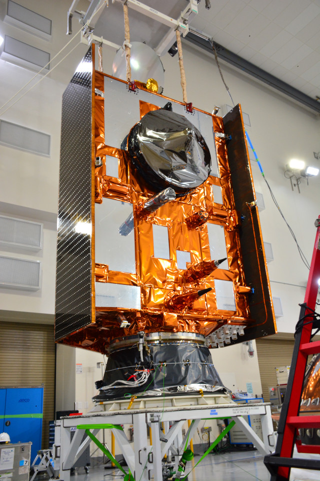
Sentinel-6A Michael Freilich is a weather and oceanographic satellite specializing in monitoring sea levels. Over the years, the Jason series satellites have already conducted this type of monitoring. This new mission aims to improve it with higher resolution detections that will allow to obtain more detailed information. A series of instruments will be used to do the job, in particular the radio altimeter.
The primary mission of the Sentinel-6B satellite remains linked to ocean monitoring. Collecting data on climate change is crucial for the future of the planet and especially for the future of humanity. The impact of rising sea levels must be accurately assessed to understand, among other things, the risks that will affect coastal areas, with the possible consequences on inhabited areas. A global collaboration will get information about a global problem, hoping that we can find some solutions soon.
The Sentinel-6B satellite is under the supervision of ESA’s mission control center in Germany, as planned for the operations required during the so-called Launch and Early Orbit Phase. Once that phase ends, day-to-day operations will be handed over to EUMETSAT, the intergovernmental organization whose main objective is exactly to run the European network of meteorological satellites. In this case, the mission is scheduled to last 5.5 years.