ESA has released the last image taken by its Rosetta space probe before clashing on the surface of comet 67P/Churyumov-Gerasimenko at the end of its mission along with the story of its reconstruction. The image was incomplete, so initially it wasn’t recognized as such by the automatic processing software among the packets containing telemetry data it was transmitted with.
The mission of the Rosetta space probe ended nearly exactly a year ago, on September 30, 2016. After more than two years spent in orbit around comet 67P/Churyumov-Gerasimenko, it performed its final act clashing on its surface but until the last minute sent telemetry data along with increasingly clos images of the surface. The huge amount of data collected during this extraordinary mission keeps on being analyzed and that’s true for those received during Rosetta’s descent as well.
At the Max Planck Institute for Solar System Research in Göttingen, Germany, engineers examined those data and found some packages that weren’t processed. In the course of the operations, the images were also broken into telemetric packets aboard the Rosetta space probe and sent in that format and all the complete images were processed on Earth. However, of the last one taken 12,228 bytes of the total 23,048 arrived, three packets out of the six that composed it, with the consequence that there was no automatic processing.
The image is compressed and the data weren’t sent pixel by pixel but layer by layer with each layer more detailed than the previous one. A full image has a compression ratio of 1:20, whereas the one of which only 53% arrived has a compression ratio of 1:38 so it’s definitely less detailed but it was still possible to reconstruct it.
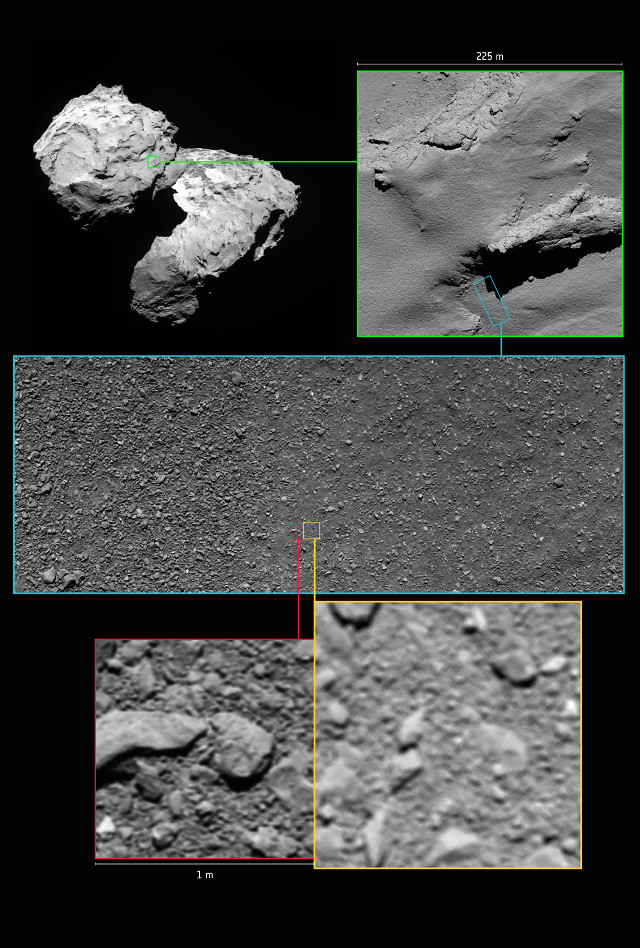
The OSIRIS camera wasn’t designed to take pictures at distances below a few hundred meters so ESA engineers adopted a special configuration for the descent on the 67P/Churyumov-Gerasimenko. The last image was captured at an altitude between 17.9 and 21 meters. The last full image was captured at an altitude between 23.3 to 26.2 meters.
The reconstructed image was presented for the first time in May 2017. Subsequently, it was used to reconstruct more accurately the descent of the Rosetta space probe and to obtain further information on the area of its impact, later called Sais. These are some more details added to a mission that made history.